We got up early intent on covering a lot of ground today. Yesterday’s clouds had cleared, but it had gotten even colder. It was only 2 degrees C when we got up, but warmed to 8 degrees by 9am when we got underway. As cold as it was, we were still better off than some, as areas to the northeast had received up to 10 inches of snow overnight!
We broke the ride into thirds with two stops for food and to warm up and ended up putting a lot of distance behind us.
We rode into West Virginia on the I77 to a point north of Beckley, and then north on Hwy 19, stopping for a diner lunch outside of Summersville. From Summersville we continued north to the I79 stopping in Washington, Pennsylvania for a warm-up before passing through Pittsburgh and on to Grove City for the night.
Despite the cold, we rode almost 570km’s today and have only about 500km’s further to go before completing our journey.
Wednesday, April 28, 2010
Tuesday, April 27, 2010
Cherokee, NC to Wytheville, VA – April 27
What a miserable day. The weather was terrible again. It was raining so hard this morning we waited until 11am before moving. Even in a light drizzle we were soaked quickly by wheel spray from other vehicles as we rode the Appalachian Expressway to Asheville, North Carolina.
We had a nice lunch at the Lucky Otter in Asheville – it’s a small restaurant where everything is made on site. Good food.
After lunch we rode the I26 to Johnson City, Tennessee, where the sky turned green and black again. As we turned north on the the I81 and into Virginia the storm let loose and we were soaked again, but able to stay ahead of the worst downpours.
By 5pm we had reached Wytheville and stopped to look for accommodation for the night. It was only 8 to 10 degrees C for most of the day and we were frozen through.
We’re just a few miles from the West Virginia State line, so if the weather clears up for tomorrow, we’ll try to cross West Virginia and continue into Pennsylvania.
Monday, April 26, 2010
Chattanooga, TN to Cherokee, NC – April 26
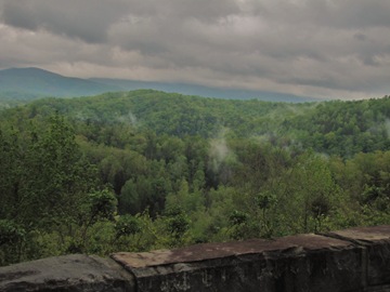
More crazy weather today, as yesterday’s wind has brought in a cold front with lots of rain. We rode north from Chattanooga in 55 degree drizzle, a bit of a shock after the last month of 85 to 105!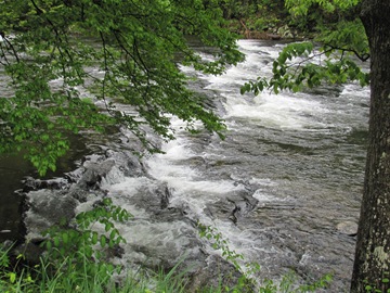 We took the Cherahola Skyway across the Great Smoky Mountains and into North Carolina. The Skyway is supposed to be impressive for it’s combination of dramatic curves and even more dramatic views. The curves were good, the view not so much, as low wet clouds had socked in the pass. Visibility in the higher elevations was reduced to a matter of feet at times, and we were turning blue until the elevation dropped again.
 From Robbinsville we headed for Deal’s Gap to run the “Tail of the Dragon”. The Dragon is a famous stretch of Hwy 129 that contains 318 curves in 11 miles. There’s a restaurant hotel right at the start of the dragon where we stopped for lunch just as the skies opened up. By 2pm the rain had let up, but in the mean time we had learned that although the road was open, it was not a through road. Apparently there was a rock slide further north during the winter and the road is still blocked, but they’ve kept the twisties open for enthusiasts.
 After being “forced” to run the dragon twice, we rode some backroads to Hwy 74 to continue north. The weather was still against us as heavy rains started again. Once we were sufficiently soggy and cold we stopped for the night in Cherokee, just outside of Asheville (where the Obama’s spent the weekend).
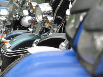 We’re back on the main roads tomorrow, riding north into Virginia.
 We took the Cherahola Skyway across the Great Smoky Mountains and into North Carolina. The Skyway is supposed to be impressive for it’s combination of dramatic curves and even more dramatic views. The curves were good, the view not so much, as low wet clouds had socked in the pass. Visibility in the higher elevations was reduced to a matter of feet at times, and we were turning blue until the elevation dropped again.
 From Robbinsville we headed for Deal’s Gap to run the “Tail of the Dragon”. The Dragon is a famous stretch of Hwy 129 that contains 318 curves in 11 miles. There’s a restaurant hotel right at the start of the dragon where we stopped for lunch just as the skies opened up. By 2pm the rain had let up, but in the mean time we had learned that although the road was open, it was not a through road. Apparently there was a rock slide further north during the winter and the road is still blocked, but they’ve kept the twisties open for enthusiasts.
 After being “forced” to run the dragon twice, we rode some backroads to Hwy 74 to continue north. The weather was still against us as heavy rains started again. Once we were sufficiently soggy and cold we stopped for the night in Cherokee, just outside of Asheville (where the Obama’s spent the weekend).
 We’re back on the main roads tomorrow, riding north into Virginia.
Sunday, April 25, 2010
Tupelo, MS to Chattanooga, TN – April 25
Actually we’re in Cleveland, Tennessee near Dayton – but we’ve just passed through Chattanooga and that seems a lot less confusing to me!
I forgot to mention Petra’s bike conked out again early yesterday just after we got underway – same symptoms as in Texas. I disconnected the igniter module and reconnected it and the bike ran like a charm. Seems the moisture from the rain causes some kind of short that gets remedied with the reconnect – for now!
We rode the Natchez Trace from Tupelo, birthplace of Elvis Presley, northeast cutting the corner of Alabama and then into Tennessee in Lawrence County, where Davey Crockett led the local militia in the early 1800’s.
We left the Natchez Trace at State Highway 64 and rode east. Yesterday’s storms are gone but the wind was still very strong, making for difficult riding at times.
There are a remarkable number of fireworks stores in the south, each one trying to out-do the last with discounts and special offers like “buy 1 get 4 free”. You wouldn’t think there was any money to be made given the number of stores, and some of them are enormous!
Tomorrow we’re heading to Deal’s Gap to ride the Tail of the Dragon – 318 curves in 11 miles – and then on to Knoxville.
I forgot to mention Petra’s bike conked out again early yesterday just after we got underway – same symptoms as in Texas. I disconnected the igniter module and reconnected it and the bike ran like a charm. Seems the moisture from the rain causes some kind of short that gets remedied with the reconnect – for now!
We rode the Natchez Trace from Tupelo, birthplace of Elvis Presley, northeast cutting the corner of Alabama and then into Tennessee in Lawrence County, where Davey Crockett led the local militia in the early 1800’s.
We left the Natchez Trace at State Highway 64 and rode east. Yesterday’s storms are gone but the wind was still very strong, making for difficult riding at times.
There are a remarkable number of fireworks stores in the south, each one trying to out-do the last with discounts and special offers like “buy 1 get 4 free”. You wouldn’t think there was any money to be made given the number of stores, and some of them are enormous!

Tomorrow we’re heading to Deal’s Gap to ride the Tail of the Dragon – 318 curves in 11 miles – and then on to Knoxville.
Saturday, April 24, 2010
Natchez to Tupelo – April 24
So the local weather forecasts were bang on – a lot of big, fast moving storms slammed through Mississippi this morning including a number of tornadoes. It seems there may have been up to 10 fatalities.
We stayed put in Natchez until noon, as the radar showed bands of storms to the northwest and northeast moving in a north-easterly direction (i.e. exactly our path of travel). As we got underway, a couple of systems were just ahead of us but moving away faster than we were travelling. I have not before seen clouds move as quickly as we saw today.

We rode the Natchez Trace Parkway diagonally across Mississippi, it’s a 444-mile route that commemorates an ancient trail used by animals and people that connected southern portions of the Mississippi River, through Alabama, to salt licks in today's central Tennessee.

It was a beautiful ride, and we had the road almost entirely to ourselves as the storms seemed to have kept the tourists away. In fact, outside of French Camp the Trace was closed as a tornado had knocked about 100 trees into the road. We were turned back about 25km’s for a detour, reconnecting with the Trace north of the closure and continuing on to Tupelo for the night.
We stayed put in Natchez until noon, as the radar showed bands of storms to the northwest and northeast moving in a north-easterly direction (i.e. exactly our path of travel). As we got underway, a couple of systems were just ahead of us but moving away faster than we were travelling. I have not before seen clouds move as quickly as we saw today.

We rode the Natchez Trace Parkway diagonally across Mississippi, it’s a 444-mile route that commemorates an ancient trail used by animals and people that connected southern portions of the Mississippi River, through Alabama, to salt licks in today's central Tennessee.

It was a beautiful ride, and we had the road almost entirely to ourselves as the storms seemed to have kept the tourists away. In fact, outside of French Camp the Trace was closed as a tornado had knocked about 100 trees into the road. We were turned back about 25km’s for a detour, reconnecting with the Trace north of the closure and continuing on to Tupelo for the night.
Natchez, Mississippi – April 23
We’re not moving today.
I’ve got a flu bug, and yesterday’s “patagonia” winds have developed into quite a severe weather system. Most of Texas, and all of Louisiana and Mississippi are under a Tornado Alert. There’s been a few nasty thunderstorms, large hail, and a number of tornado’s have touched down but none in our immediate area, we’ve only had heavy downpours. The severity of the system is forecast to get worse overnight and into midday tomorrow, so we’ll keep an eye on the radar on the Weather Channel. I’m not doing anything but watching TV anyway, and they interrupt the broadcasts with warnings if things get dicey.
Hopefully things clear up (flu and weather), so we can get back on the road tomorrow.
I’ve got a flu bug, and yesterday’s “patagonia” winds have developed into quite a severe weather system. Most of Texas, and all of Louisiana and Mississippi are under a Tornado Alert. There’s been a few nasty thunderstorms, large hail, and a number of tornado’s have touched down but none in our immediate area, we’ve only had heavy downpours.
 The severity of the system is forecast to get worse overnight and into midday tomorrow, so we’ll keep an eye on the radar on the Weather Channel. I’m not doing anything but watching TV anyway, and they interrupt the broadcasts with warnings if things get dicey.
Hopefully things clear up (flu and weather), so we can get back on the road tomorrow.
Houston, TX to Natchez, Mississippi – April 22
Another tough day of highway riding as we left Houston on the I-10 and rode it all the way to Baton Rouge. It was “patagonia” windy, so we got quite a workout keeping the bikes on track and our heads attached.
We stopped at a Tourist Information station outside Lafayette. They had a couple of adult alligators on display, and a young one (about 7 months old) that we were able to hold. From Baton Rouge north to Natchez we had a nicer ride along Hwy 61 before stopping in Natchez for the night.
We stopped at a Tourist Information station outside Lafayette. They had a couple of adult alligators on display, and a young one (about 7 months old) that we were able to hold.
 From Baton Rouge north to Natchez we had a nicer ride along Hwy 61 before stopping in Natchez for the night.
Thursday, April 22, 2010
Harlingen to Houston - April 21
No pictures today - we just got on the road and twisted the throttle to Houston. The road was flat, straight, and boring, making for a long day.
We're both a bit road weary, so the boredom allows every little ache and pain to accentuate itself!
The Carter brothers gave us a Harley Owners Group Touring Manual that highlights the more scenic and interesting routes to ride in each State. I've spent some time studying the maps and come up with a few routes for us to follow once we get in to Louisiana and turn north.
From Houston, we'll have more highway and interstate to Baton Rouge, Louisiana but from there, we can ride the "Blues Highway" 61 north to Natchez and then cross Mississippi on the Natchez Trace Parkway all the way north across the corner of Alabama and into Tennessee.
Tuesday, April 20, 2010
Harlingen, Texas – April 20
So the plan was simple, zip back to Mexico, cancel our import permits and head north to Louisiana – except Petra’s bike didn’t want to cooperate.
About 5km’s from the border, the bike back-fired, lost power, and she coasted to a stop on the side of the road. I went through the checklist of obvious solutions to no avail, and eventually went to a nearby farmhouse to borrow a phone and yellow pages to find a shop and lift truck. Unfortunately, I learned there was no lift truck service anywhere close to us, but I did get some advice regarding the problem.
Robert Carter, from The Cycle Connection thought we had probably got some bad fuel while in Mexico, and suggested I drain the carburettor float to see if that would allow the engine to start long enough to get the bike into the shop. I drained the float, but it didn’t work. As I stood there scratching my head about what to do next a man drove up and offered to help. He introduced himself as Margarito or “Meggie” for short, and proposed to go and get his pick-up truck and drive the bike to the shop for us.
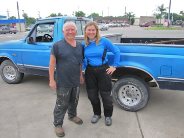 Meggie and his truck with Petra.
 With that, we were on the road to the border to get the permits cancelled. It was 4:30pm by the time we got to Mexican Aduana, so we’ll stay in Harlingen again tonight and get an early start tomorrow.
About 5km’s from the border, the bike back-fired, lost power, and she coasted to a stop on the side of the road. I went through the checklist of obvious solutions to no avail, and eventually went to a nearby farmhouse to borrow a phone and yellow pages to find a shop and lift truck. Unfortunately, I learned there was no lift truck service anywhere close to us, but I did get some advice regarding the problem.
Robert Carter, from The Cycle Connection thought we had probably got some bad fuel while in Mexico, and suggested I drain the carburettor float to see if that would allow the engine to start long enough to get the bike into the shop. I drained the float, but it didn’t work. As I stood there scratching my head about what to do next a man drove up and offered to help. He introduced himself as Margarito or “Meggie” for short, and proposed to go and get his pick-up truck and drive the bike to the shop for us.
 Meggie and his truck with Petra.
10 minutes later we had the bike loaded and were off to the shop.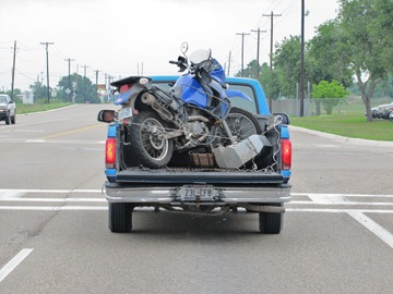
Rob and his brother Ray removed the gas tank and carburettor and cleaned it, but when they reinstalled it, the bike wasn’t generating any power to the spark plug. We talked about the electrical problems we experienced in El Salvador, but eventually reduced the possible problems to a bad igniter, or a bad crankshaft sensor switch. Apparently there is no way to test an igniter, so dealerships keep a functional unit around to compare with suspect units – Robert didn’t have one, but I did – in my bike! He tried it in Petra’s bike and it started like a charm. Given the rough treatment Petra’s bike has received on the trip he gave the contacts a good clean and replaced the original igniter – and it worked!
 With that, we were on the road to the border to get the permits cancelled. It was 4:30pm by the time we got to Mexican Aduana, so we’ll stay in Harlingen again tonight and get an early start tomorrow.
Playa Miramar, Mexico to Harlingen, Texas – April 19
We had a long day of highway riding today, including one leg of over 250km’s. The roads were great, and virtually clear of traffic so as we got further north we realized we might make it across the border to Texas today.
We headed for the Puente Internacional Libre Commercio and arrived at 6pm. Unfortunately, we need to have our temporary vehicle import permits cancelled at the Banjercito, which despite the border being open 24hrs, was closed. With no safe accommodation on the Mexican side, we decided to cross the border anyway and ended up staying in Harlingen, Texas for the night.
We’ll head back across to Mexico first thing in the morning to deal with the permit cancellation, and then continue north.
Adios Mexico and Latin America!
Nautla to Playa Miramar – April 18
We rode to the ruins of El Tajin in the morning. El Tajin is a UNESCO World Heritage Site described as:
El Tajin was at its height from the early 9th to the early 13th century. It became the most important centre in north-east Mesoamerica after the fall of the Teotihuacan Empire. Its cultural influence extended all along the Gulf and penetrated into the Maya region and the high plateaux of central Mexico. Its architecture, which is unique in Mesoamerica, is characterized by elaborate carved reliefs on the columns and frieze. The 'Pyramid of the Niches', a masterpiece of ancient Mexican and American architecture, reveals the astronomical and symbolic significance of the buildings. El Tajin has survived as an outstanding example of the grandeur and importance of the pre-Hispanic cultures of Mexico.

 After lunch, we headed north through Tampico and Ciudad Madero, stopping at Playa Miramar for the night.
We ate dinner at Tortugas along the beach drag. I had a Caldo Marisco with Robalo and delicious Shrimp Gigantes. Petra had a bucket of Tequila Sour!
El Tajin was at its height from the early 9th to the early 13th century. It became the most important centre in north-east Mesoamerica after the fall of the Teotihuacan Empire. Its cultural influence extended all along the Gulf and penetrated into the Maya region and the high plateaux of central Mexico. Its architecture, which is unique in Mesoamerica, is characterized by elaborate carved reliefs on the columns and frieze. The 'Pyramid of the Niches', a masterpiece of ancient Mexican and American architecture, reveals the astronomical and symbolic significance of the buildings. El Tajin has survived as an outstanding example of the grandeur and importance of the pre-Hispanic cultures of Mexico.


 After lunch, we headed north through Tampico and Ciudad Madero, stopping at Playa Miramar for the night.
 We ate dinner at Tortugas along the beach drag. I had a Caldo Marisco with Robalo and delicious Shrimp Gigantes.
 Petra had a bucket of Tequila Sour!
Monte Pio to Nautla – April 17
The morning ride from Monte Pio out to Angel Cabrada was similar to the ride in, tight curves, lush tropical green mountain landscape, and plenty of topes.
Topes is the mexican term for each of the multitude of speed bumps placed across any populated section of road. They must be quite severe for cars and trucks, because drivers slow to a virtual stop to pass over them, creating long lines of traffic behind. Our bikes barely notice the bumps, and if we stand on the pegs, we can ride across them at 60kmh. At first a nuisance, the topes quickly became our allies in passing buses, trucks, and other vehicles – as they’d slow we would sail past them unhindered – especially useful given that most of the trucks are double length trailers. We rode through Boca del Rio and Veracruz around lunchtime with little trouble. They are beautiful and modern cities with a mix of new and colonial buildings, and a long beach waterfront.
 Lunch was in a roadside restaurant outside of Los Palmas. I had a delicious Pulpos (octopus) Veracruz. The sauce was tomato based with onions and tarragon, and a delicious chile picante on the side.
We stopped for the night in Nautla, at the Hotel Istirincha. The hotel has a number of crocodiles on the grounds, as well as Toucans.
 We’re heading to see the ruins of El Tajin in the morning.
Topes is the mexican term for each of the multitude of speed bumps placed across any populated section of road. They must be quite severe for cars and trucks, because drivers slow to a virtual stop to pass over them, creating long lines of traffic behind. Our bikes barely notice the bumps, and if we stand on the pegs, we can ride across them at 60kmh. At first a nuisance, the topes quickly became our allies in passing buses, trucks, and other vehicles – as they’d slow we would sail past them unhindered – especially useful given that most of the trucks are double length trailers.
 We rode through Boca del Rio and Veracruz around lunchtime with little trouble. They are beautiful and modern cities with a mix of new and colonial buildings, and a long beach waterfront.
 Lunch was in a roadside restaurant outside of Los Palmas. I had a delicious Pulpos (octopus) Veracruz. The sauce was tomato based with onions and tarragon, and a delicious chile picante on the side.
 We stopped for the night in Nautla, at the Hotel Istirincha. The hotel has a number of crocodiles on the grounds, as well as Toucans.

 We’re heading to see the ruins of El Tajin in the morning.
Sunday, April 18, 2010
Juchitan to Monte Pio – April 16
There has been no shortage of rain in this part of Mexico, evidenced by flooded fields and numerous swollen muddy rivers that we crossed on our way from coast to coast. The skies were fairly ominous for most of the day as well, but the rain held off.
We had decided to stay outside of Vera Cruz for the night, at the tiny village of Monte Pio. The road to Monte Pio passes through Catemaco, adjacent to the Laguna of the same name. The views were spectacular, and the road soon became narrow with a dense jungle canopy above as we rode through the Volcan San Martin Biosphere Reserve and down towards the Gulf of Mexico.

 This is the first time we have seen the Atlantic Ocean since leaving Argentina for Tierra del Fuego.
 Monte Pio fits its billing of “tiny village”, being a collection of only about 25 buildings including one operating hotel where we checked in for the night.
 We rode the short distance down to the sea-shore, and ate dinner in an open-air restaurant right on the beach while a local fisherman tried his hand with a net in the surf.
 Tomorrow we’ll ride north along the coast past Vera Cruz, up towards Papantla.
We had decided to stay outside of Vera Cruz for the night, at the tiny village of Monte Pio. The road to Monte Pio passes through Catemaco, adjacent to the Laguna of the same name.
 The views were spectacular, and the road soon became narrow with a dense jungle canopy above as we rode through the Volcan San Martin Biosphere Reserve and down towards the Gulf of Mexico.

 This is the first time we have seen the Atlantic Ocean since leaving Argentina for Tierra del Fuego.
 Monte Pio fits its billing of “tiny village”, being a collection of only about 25 buildings including one operating hotel where we checked in for the night.
 We rode the short distance down to the sea-shore, and ate dinner in an open-air restaurant right on the beach while a local fisherman tried his hand with a net in the surf.
 Tomorrow we’ll ride north along the coast past Vera Cruz, up towards Papantla.
Friday, April 16, 2010
Tapachula to Juchitan – April 15
The Mexican Aduana is on the highway north of Tapachula in the direction we are travelling, which is convenient, but we needed to stop there to obtain temporary import permits for the bikes. By the time the paperwork was done it was 10:30am and we were on our way north.

Highway 200 is a four-lane divided highway for the most part, except where it passes through towns, so we made good time. There were some serious looking thunderstorms coming out of the mountains to the east, but other than one sprinkle and a good five minute soaking we stayed ahead of the storms all day. It’s so hot we were dry in a few minutes.

We got into Juchitan at about 4:30pm, and got checked in to a local hotel by 5:30pm. It’s a friendly town that doesn’t get many gringo visitors so we stick out like sore thumbs!
I’ve developed a bad infection in my ears (probably from all the swimming). I caught it in time for the right ear, but the left ear is a mess and very painful so I’m back on the antibiotics to kick it. For the time being taking off my helmet is torture!
We’re going to cut across the country to the Atlantic tomorrow. We’re at the narrowest point between the Pacific and the Atlantic, so we’ll see if we can reach Vera Cruz.

Highway 200 is a four-lane divided highway for the most part, except where it passes through towns, so we made good time. There were some serious looking thunderstorms coming out of the mountains to the east, but other than one sprinkle and a good five minute soaking we stayed ahead of the storms all day. It’s so hot we were dry in a few minutes.

We got into Juchitan at about 4:30pm, and got checked in to a local hotel by 5:30pm. It’s a friendly town that doesn’t get many gringo visitors so we stick out like sore thumbs!
We’re going to cut across the country to the Atlantic tomorrow. We’re at the narrowest point between the Pacific and the Atlantic, so we’ll see if we can reach Vera Cruz.
Thursday, April 15, 2010
Barra San Diego, El Salvador to Tapachula, Mexico – April 14
We left the beach at Barra San Diego at 7:30am and headed for the Guatemalan frontier at La Hachadura, with the goal being to get through Guatemala quickly and get as close to the Mexican border as possible before stopping for the day.
Guatemala is a beautiful country, but we have heard too many bad things about violent crime against tourists here recently, and we want to keep moving north anyway – so we’ve decided to twist the throttle a bit.
Getting across the border was the usual slow Central American hassle, with 15 to 20 people steaming in the heat outside a tiny window waiting for paperwork to be completed by uninterested customs officials sitting behind the glass in air-conditioned bliss. It was 11am by the time we were away from the border and headed north.
Thanks to Guatemala’s mostly excellent roads, and little traffic save for the last 100km’s towards the Mexican frontier we made great time and were at the border at Ciudad Hidalgo by 3:30pm. The dilemma then became whether to begin the crossing process or wait for tomorrow morning – the problem being if the process takes too long, we are stuck looking for accommodation after dark. Compounding the concern was the uncertainty about Mexican Aduana fees (if any) and method of payment etc.
The Guatemalan Aduana officials were fairly insistent that we would not suffer delays on the Mexican side and also that fees could be paid with credit cards (they seemed as anxious to see us go as we were wanting to go!) – so we decided to risk it and headed for Mexico.
The Mexican Immigration process was easy, and the import permit for the bikes is actually dealt with about 40km’s from the border, outside Tapachula where we wanted to stay the night – so we were on our way by 5pm with ample time to find a place for the night before dark. If I hadn’t gotten us lost looking for a hotel we might even have had a relaxing evening. As it turns out we found an OK place near centro just as the sun was setting. We walked a short way to the main square, Parque Hidalgo, where we ate local cuisine at an open air restaurant Los Tomales Grill.
 Tomorrow we’re heading up the Pacific Coast towards Juchitan.
Guatemala is a beautiful country, but we have heard too many bad things about violent crime against tourists here recently, and we want to keep moving north anyway – so we’ve decided to twist the throttle a bit.
Getting across the border was the usual slow Central American hassle, with 15 to 20 people steaming in the heat outside a tiny window waiting for paperwork to be completed by uninterested customs officials sitting behind the glass in air-conditioned bliss. It was 11am by the time we were away from the border and headed north.
Thanks to Guatemala’s mostly excellent roads, and little traffic save for the last 100km’s towards the Mexican frontier we made great time and were at the border at Ciudad Hidalgo by 3:30pm. The dilemma then became whether to begin the crossing process or wait for tomorrow morning – the problem being if the process takes too long, we are stuck looking for accommodation after dark. Compounding the concern was the uncertainty about Mexican Aduana fees (if any) and method of payment etc.
The Guatemalan Aduana officials were fairly insistent that we would not suffer delays on the Mexican side and also that fees could be paid with credit cards (they seemed as anxious to see us go as we were wanting to go!) – so we decided to risk it and headed for Mexico.
The Mexican Immigration process was easy, and the import permit for the bikes is actually dealt with about 40km’s from the border, outside Tapachula where we wanted to stay the night – so we were on our way by 5pm with ample time to find a place for the night before dark. If I hadn’t gotten us lost looking for a hotel we might even have had a relaxing evening. As it turns out we found an OK place near centro just as the sun was setting.
 We walked a short way to the main square, Parque Hidalgo, where we ate local cuisine at an open air restaurant Los Tomales Grill.
 Tomorrow we’re heading up the Pacific Coast towards Juchitan.
San Salvador to Barra Santiago – April 13
I was back at the shop for 8am to see about getting Petra’s bike reassembled in a timely fashion. It took some time to fabricate a new return spring for her starter button, but it was finally done and ready to go by 11am.
Unbelievably, as we began to move the bikes outside to reattach the panniers, one of the mechanics noticed that my new rear tire had gone flat in the night. The tube had been punctured in the tire swap. That’s puncture number seven, but at least I didn’t have to fix it on the side of the road in Guatemala.
The boys quickly removed the wheel and sent it back across town to the tire shop to be repaired. Unfortunately, the repair didn’t get completed until close to 2pm, leaving us very little riding time on a border crossing day.
We rode back to the ocean in La Libertad and then along the coast highway past Acajutla to Barra de Santiago, a beach town on the pacific.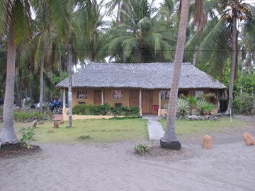 The ride was hot again, especially as I stewed over the time lost to unnecessary repairs, and our inability to get any further distance today, so we ran for a swim in the surf straight away before the sun had set.
 We’re hitting the sack early so that we can get started for the Guatemalan frontera at first light. The border’s only 30km away, but we want to give ourselves as much riding time in Guatemala as possible and get to Mexico as soon as we can.
Unbelievably, as we began to move the bikes outside to reattach the panniers, one of the mechanics noticed that my new rear tire had gone flat in the night. The tube had been punctured in the tire swap. That’s puncture number seven, but at least I didn’t have to fix it on the side of the road in Guatemala.
The boys quickly removed the wheel and sent it back across town to the tire shop to be repaired. Unfortunately, the repair didn’t get completed until close to 2pm, leaving us very little riding time on a border crossing day.
We rode back to the ocean in La Libertad and then along the coast highway past Acajutla to Barra de Santiago, a beach town on the pacific.
 The ride was hot again, especially as I stewed over the time lost to unnecessary repairs, and our inability to get any further distance today, so we ran for a swim in the surf straight away before the sun had set.
 We’re hitting the sack early so that we can get started for the Guatemalan frontera at first light. The border’s only 30km away, but we want to give ourselves as much riding time in Guatemala as possible and get to Mexico as soon as we can.
Playa San Diego to San Salvador – April 12
We left Playa San Diego just after 7am and were in San Salvador at the Kawasaki Dealership by 8:30am with little trouble finding the place.
The bike service was underway by 9am and we set about finding tires. Eventually, appropriate tires were found at another location across town, so I went with Victor, the Shop Manager, to deliver our wheels.
An hour later the bikes were still not complete and we were told it would be another hour. At this point I started to get frustrated because it wouldn’t take that long for me to finish both bikes myself. After I pushed a bit, the mechanics admitted there was an electrical problem with Petra’s bike – the ignition switch was overheating, and alternatively the regulator fuse would blow. I went into the shop area to see what was up and saw them reefing the gas tank off of the frame with the fairings still attached on either side, and proceeding to yank on the wiring harness, disconnecting circuits left and right.
As they tried to test individual circuits with the starter button, we pointed out that they had cut the side stand kill switch and therefore were not going to know when or if the problem was solved.
After the side stand switch was reconnected, I stayed with the mechanics and forced them to work in a more methodical fashion to diagnose the problem. It turned out, they had initially removed the gas tank in the same inappropriate manner we had witnessed, and in the process had crimped a wire in the wiring harness that runs under the tank. When the tank was replaced, the crimped wire would short the ignition circuit (it actually melted the solder off of the back of the starter button and destroyed a return spring), and blow out the fuse in the regulator.
We rerouted the wiring harness to avoid any more damage, removed the fairing to properly reinstall the fuel tank, had to send someone out for replacement fuses, and re-soldered the starter switch before the shop closed for the night.
In the mean time, Petra had gotten us checked in to a hotel a few doors down from the shop.
Tomorrow morning we’ll have to make a new spring for the starter and finish reassembling the bike before getting underway.
Sunday, April 11, 2010
Playa San Diego – April 11
It’s a vacation day from the bikes, and no better place for it. I got up at 7am and read some e-mail before going for a 2 hour swim in the waves. The waves were big this morning and bigger again just after noon.
 We are eating like kings here, fantastic fish and giant shrimp for dinner last night, breakfast was eggs with cheese, toast and bacon, and lunch is fresh fish!
I spent some time studying the San Salvador map, so we’ve decided to stay in Playa San Diego tonight and head into the city early tomorrow morning for the bike service.
Caroline’s friends , Leo and “Ne-ne” joined us for dinner. Leo is a Mayan Shaman, and both he and Ne-ne are extremely knowledgeable about indigeno culture.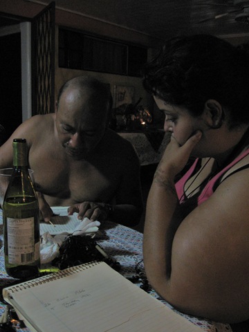 Leo did our numerology and birth signs for us, and performed a cleansing ceremony to cast out any bad spirits and wish us good fortune on the ride home.
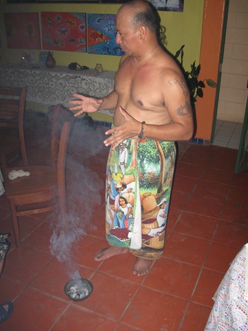 It was a lot of fun, and a great evening getting to know some real Salvadorans!
 The waves were big this morning and bigger again just after noon.
  We are eating like kings here, fantastic fish and giant shrimp for dinner last night, breakfast was eggs with cheese, toast and bacon, and lunch is fresh fish!
 I spent some time studying the San Salvador map, so we’ve decided to stay in Playa San Diego tonight and head into the city early tomorrow morning for the bike service.
Caroline’s friends , Leo and “Ne-ne” joined us for dinner. Leo is a Mayan Shaman, and both he and Ne-ne are extremely knowledgeable about indigeno culture.
 Leo did our numerology and birth signs for us, and performed a cleansing ceremony to cast out any bad spirits and wish us good fortune on the ride home.
 It was a lot of fun, and a great evening getting to know some real Salvadorans!
Santa Rosa to Playa San Diego – April 10
We have an appointment to service the bikes in San Salvador on Monday morning. The service is way overdue, and my rear tire is in bad shape so we can’t put it off any longer.
There’s a beach resort area around Puerto La Libertad with some world famous surf breaks, and its only 35km from San Salvador so we decided to head there instead of directly to San Salvador.
It’s incredibly hot here. We’re riding at 90 to 110kmh in 42 degrees C, and when we stop the LCD thermometer sometimes just turns black!
We had read that La Libertad can sometimes have some crime problems, although there is a lot of tourism development underway, so we decided to look for a beach house just outside of town in Playa San Diego. We looked at a few options, but all the nicer properties seemed to be closed or unavailable. One decent looking place had its gate open so I rode in and asked if a room was available. The fellow said that the whole place had been rented out, but he knew a lady from Canada that would have room at another location… Welcome to paradise…Caroline (Carolina to the locals) is retired from Vancouver Island, and has been living here for 4 years since she bought this bed and breakfast or “rancho” as it’s called here.
 The beautiful quarter acre property backs right onto the spectacular beach where the surf pounds endlessly.
We ran straight for the beach and swam in the 80 degree plus surf for an hour. The waves are strong, and the currents are incredible so it was quite a workout. Lucky for me I float like a cork in salt water. From the ocean we went straight to the pool and floated there as the sun set and we were completely water logged.

There’s a beach resort area around Puerto La Libertad with some world famous surf breaks, and its only 35km from San Salvador so we decided to head there instead of directly to San Salvador.
It’s incredibly hot here. We’re riding at 90 to 110kmh in 42 degrees C, and when we stop the LCD thermometer sometimes just turns black!
We had read that La Libertad can sometimes have some crime problems, although there is a lot of tourism development underway, so we decided to look for a beach house just outside of town in Playa San Diego. We looked at a few options, but all the nicer properties seemed to be closed or unavailable. One decent looking place had its gate open so I rode in and asked if a room was available. The fellow said that the whole place had been rented out, but he knew a lady from Canada that would have room at another location…
 Welcome to paradise…Caroline (Carolina to the locals) is retired from Vancouver Island, and has been living here for 4 years since she bought this bed and breakfast or “rancho” as it’s called here.
 The beautiful quarter acre property backs right onto the spectacular beach where the surf pounds endlessly.
We ran straight for the beach and swam in the 80 degree plus surf for an hour. The waves are strong, and the currents are incredible so it was quite a workout. Lucky for me I float like a cork in salt water. From the ocean we went straight to the pool and floated there as the sun set and we were completely water logged.


Saturday, April 10, 2010
Chinandega, Nicaragua to Santa Rosa, El Salvador – April 9
Welcome to Honduras, don’t let the door hit your a$$ on the way out…
We were always planning to take the shortest route through Honduras, as the whole “coup no coup” problem was unresolved during the trip planning stages. I had also read a few unflattering accounts of crooked cops shaking down tourists, and had those fears confirmed by a southbound American rider that I met in Penas Blanca, Nicaragua while waiting for import docs. He had been stopped by bent policia 9 times in the 125km stretch from El Salvador to Nicaragua.
We left Chinandega at 7:30 am and rode around the base of the Volcan San Cristobal on the way to the frontier at Guasaule. San Cristobal is an active volcano, with smoke and gas clearly visible venting from the cone. The ride to Guasaule was uneventful, but as we entered the aduana area we were set upon by dozens of “helpers”, jumping in front of our bikes and competing for our attention in the hopes that we might hire them as border agents. The trouble is the whole situation is so unsavoury, you can’t trust any of them – many people hire a “helper” only to be presented claims for all kinds of extra or special charges for expediting paperwork etc. We’ve had quite a bit of practice so far on this journey, and will continue to muddle through on our own, despite the complete lack of signage, unofficial atmosphere, and blatant collusion between so-called officials and “helpers”.
Our biggest challenge getting into Honduras was the surprise fee of $35USD per bike for temporary importation. The trouble was, we’ve never been required to pay this much and we weren’t carrying enough cash! Naturally, they only accept cash and the closest bank was 45km away. Eventually, Petra convinced the officials to issue a permit for my bike, allowing me to make the bank run and return to pay the fee for both bikes. It took close to two hours to make the run, including trying 5 cajero automaticos in Choluteca before finding one that was a) functional; and b) willing to recognize my card; and then racing back to the border.
We got away from Guasaule at 1:30pm, casting some serious doubt on our aspirations to enter El Salvador the same day. We made it to the El Salvador frontier by 3:30pm despite getting stopped at 4 policia checkpoints. We came away from the checkpoints unscathed financially, although one cop figured I owed him money for water since it was so hot out. I told him that was what I needed the money for and he couldn’t have it! As he was thinking of a comeback I said “Gracias! Adios amigo” and we rode away!
At the next checkpoint we were asked to make a “donation” to an injured officer. Petra stuffed a few Argentinian peso notes into the jar before they could tell what it was and we took off again!
The border at El Amatillo was a disaster, teeming with helpers, beggars, hawkers and the like. We tried to find the aduana to get the bikes processed out but were told that everything was now dealt with on the El Salvador side. This didn’t sit well with us, but the advice was confirmed by separate sources so we rode across the Rio Negro to El Salvador. Even the El Salvadoran migraciones officials insisted that we didn’t need to deal with Honduras anymore so off we went to the El Salvadoran Aduana, 6 km’s away, only to be sent back to our original line-up in Honduras for an exit stamp.
Back at the El Salvador aduana again, it was now almost 6pm and the sun was on it way down fast. By the time our entry paperwork was complete it was long after dark and we were facing a difficult ride. We agreed to take the first available lodging, that turned out to be a hotel off the main road in Santa Rosa. We were sharing the room with a 2.5” long cucaracha before I put the yellow pages to him in an affirmative fashion – I think we’ll be sleeping with the lights on….but hey, they have wi-fi!
We were always planning to take the shortest route through Honduras, as the whole “coup no coup” problem was unresolved during the trip planning stages. I had also read a few unflattering accounts of crooked cops shaking down tourists, and had those fears confirmed by a southbound American rider that I met in Penas Blanca, Nicaragua while waiting for import docs. He had been stopped by bent policia 9 times in the 125km stretch from El Salvador to Nicaragua.
We left Chinandega at 7:30 am and rode around the base of the Volcan San Cristobal on the way to the frontier at Guasaule. San Cristobal is an active volcano, with smoke and gas clearly visible venting from the cone.
 The ride to Guasaule was uneventful, but as we entered the aduana area we were set upon by dozens of “helpers”, jumping in front of our bikes and competing for our attention in the hopes that we might hire them as border agents. The trouble is the whole situation is so unsavoury, you can’t trust any of them – many people hire a “helper” only to be presented claims for all kinds of extra or special charges for expediting paperwork etc. We’ve had quite a bit of practice so far on this journey, and will continue to muddle through on our own, despite the complete lack of signage, unofficial atmosphere, and blatant collusion between so-called officials and “helpers”.
Our biggest challenge getting into Honduras was the surprise fee of $35USD per bike for temporary importation. The trouble was, we’ve never been required to pay this much and we weren’t carrying enough cash! Naturally, they only accept cash and the closest bank was 45km away. Eventually, Petra convinced the officials to issue a permit for my bike, allowing me to make the bank run and return to pay the fee for both bikes. It took close to two hours to make the run, including trying 5 cajero automaticos in Choluteca before finding one that was a) functional; and b) willing to recognize my card; and then racing back to the border.
We got away from Guasaule at 1:30pm, casting some serious doubt on our aspirations to enter El Salvador the same day. We made it to the El Salvador frontier by 3:30pm despite getting stopped at 4 policia checkpoints. We came away from the checkpoints unscathed financially, although one cop figured I owed him money for water since it was so hot out. I told him that was what I needed the money for and he couldn’t have it! As he was thinking of a comeback I said “Gracias! Adios amigo” and we rode away!
At the next checkpoint we were asked to make a “donation” to an injured officer. Petra stuffed a few Argentinian peso notes into the jar before they could tell what it was and we took off again!
The border at El Amatillo was a disaster, teeming with helpers, beggars, hawkers and the like. We tried to find the aduana to get the bikes processed out but were told that everything was now dealt with on the El Salvador side. This didn’t sit well with us, but the advice was confirmed by separate sources so we rode across the Rio Negro to El Salvador. Even the El Salvadoran migraciones officials insisted that we didn’t need to deal with Honduras anymore so off we went to the El Salvadoran Aduana, 6 km’s away, only to be sent back to our original line-up in Honduras for an exit stamp.
Back at the El Salvador aduana again, it was now almost 6pm and the sun was on it way down fast. By the time our entry paperwork was complete it was long after dark and we were facing a difficult ride. We agreed to take the first available lodging, that turned out to be a hotel off the main road in Santa Rosa. We were sharing the room with a 2.5” long cucaracha before I put the yellow pages to him in an affirmative fashion – I think we’ll be sleeping with the lights on….but hey, they have wi-fi!
Liberia, Costa Rica to Chinandega, Nicaragua – April 8
We had the bikes packed and ready before the sun was up. We’re only about 75km from the Nicaraguan border at Paso Canoa and we’re not sure what we’ll face in terms of delay so we want to get there early.
There was a group of Howler Monkeys waking up in the trees above the hotel. They make a pretty hideous noise – more of a shriek than a howl. It was too dark to get a decent picture, so I borrowed this one from the internet. Checking out of Costa Rica was easy, but getting in to Nicaragua was a different story. There is no signage to be seen anywhere. so getting to the right place at the right time is a question of luck and intuition. Of course there’s plenty of “helpers” around offering unsolicited advice and looking for a handout.
 On the way in, we were required to have the bikes fumigated.
I stood guard over the bikes and gear while Petra managed the migraciones and aduana processes. A lot of travellers introduced themselves as I waited, including an American from San Diego who’s riding to Ushuaia and then Buenos Aires, and on to Africa! We exchanged intel on the roads ahead in each direction, and then he gave me a couple of decent cigars before heading south! I enjoyed one of the cigars while talking to other Canadians from Alberta, a Swiss couple, and a guy from Chicago – all the while as poor Petra struggled with the paperwork. (I guess I earned that riding her bike through the worst Bolivia had to offer us!)
Outside of Paso Canoa, we rode briefly along the shores of Lago Nicaragua before heading towards Managua. There seemed to have been a recent hatch of insects in the area. Outside of Managua we took the road towards Leon, hoping to avoid the worst of the city. The first 40km of the Leon road were in bad shape, with long sections of deteriorated or non-existent pavement.
  Petra picked-up a nail in here rear tire, but fortunately no puncture of the tube. Lucky for me, because I would not have enjoyed swapping a tube out in 42 degree heat!
We finally reached Chinandega and checked into a beautiful hotel for the night, where a number of colourful paintings by local artists were on display.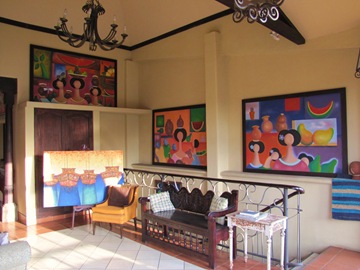
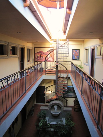
There was a group of Howler Monkeys waking up in the trees above the hotel. They make a pretty hideous noise – more of a shriek than a howl. It was too dark to get a decent picture, so I borrowed this one from the internet.
 Checking out of Costa Rica was easy, but getting in to Nicaragua was a different story. There is no signage to be seen anywhere. so getting to the right place at the right time is a question of luck and intuition. Of course there’s plenty of “helpers” around offering unsolicited advice and looking for a handout.
 On the way in, we were required to have the bikes fumigated.
I stood guard over the bikes and gear while Petra managed the migraciones and aduana processes. A lot of travellers introduced themselves as I waited, including an American from San Diego who’s riding to Ushuaia and then Buenos Aires, and on to Africa! We exchanged intel on the roads ahead in each direction, and then he gave me a couple of decent cigars before heading south! I enjoyed one of the cigars while talking to other Canadians from Alberta, a Swiss couple, and a guy from Chicago – all the while as poor Petra struggled with the paperwork. (I guess I earned that riding her bike through the worst Bolivia had to offer us!)
Outside of Paso Canoa, we rode briefly along the shores of Lago Nicaragua before heading towards Managua. There seemed to have been a recent hatch of insects in the area.
 Outside of Managua we took the road towards Leon, hoping to avoid the worst of the city. The first 40km of the Leon road were in bad shape, with long sections of deteriorated or non-existent pavement.
  Petra picked-up a nail in here rear tire, but fortunately no puncture of the tube. Lucky for me, because I would not have enjoyed swapping a tube out in 42 degree heat!
We finally reached Chinandega and checked into a beautiful hotel for the night, where a number of colourful paintings by local artists were on display.


Subscribe to:
Posts (Atom)

